CHANGING PLACES
  • Urbanisation
    • Extended Response - Urbanisation
  • Settlement patterns
  • Migration
    • Causes of internal migration
    • International Migration
    • Australia's cultural diversity
  • Australia’s Urban Future
    • Australia's Population Growth >
      • Graphs and Stats: Population Growth
      • Visual Representations: Population
      • Visual Representations: Population Density
      • Graphs and Stats: Population pyramids
    • Future Growth and Sustainability >
      • What is sustainability?
      • Sydenham to Bankstown
      • Geographical Inquiry - Urban Change in the Inner West
      • Spatial Technologies - GIS
      • Fieldwork: Marrickville
    • Sustainable Urban Places >
      • Light Rail and Metroline
      • GreenWay
      • Fieldwork: Greenway
      • WestConnex
      • Maps: WestConnex
      • Visual Representations: WestConnex infographic
      • Deindustrialisation
      • Visual Representations: Land use change in Marrickville
      • Extended response - Sustainable Urban Places
    • Contributing to a Sustainable Urban Future >
      • Community Contributions to Sustainability
      • Protests and RAGs
      • Fieldwork: WestConnex community percpetions
      • Geographical Inquiry
  • HSIE Teachers Home

Greenway

​Community groups lobbied for the continuation of a Greenway Trail along the light rail corridor to link up with the Cooks River cycleway.
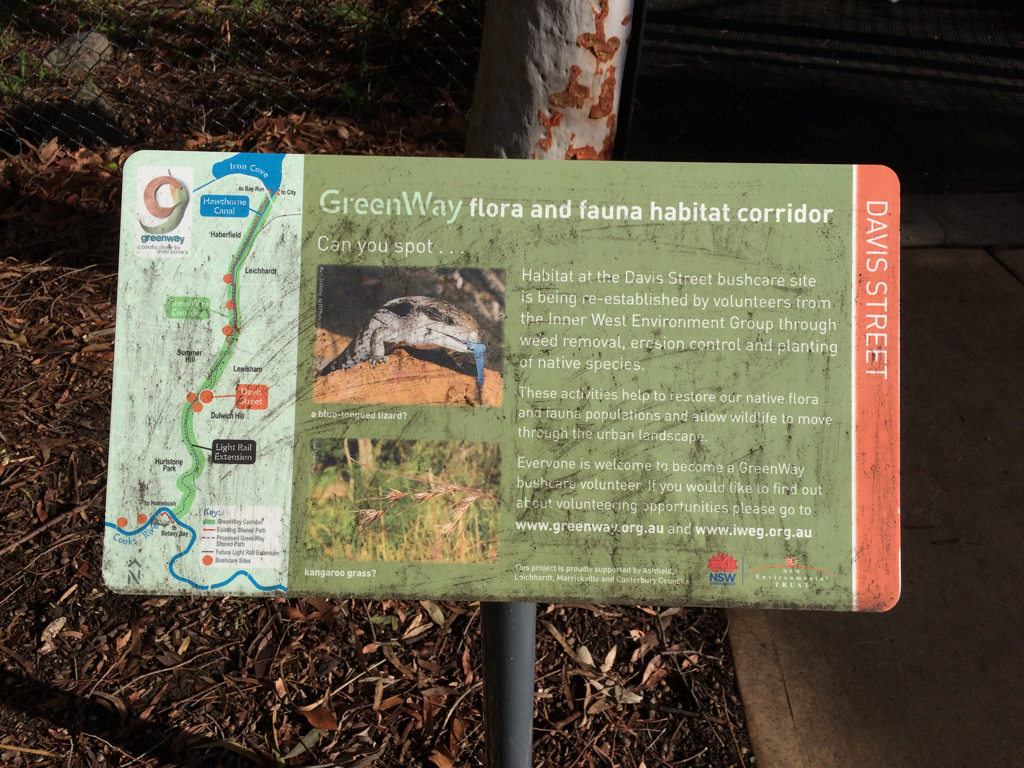
The Cooks River to Iron Cove GreenWay is a green corridor following the route of the Rozelle to Dulwich Hill light rail line. It is shared pedestrian and cyleway that links the Cooks River Cycleway and the Iron Cove BayRun. The combination of both light rail and the Greenway encourages public transport use and cycling/walking both for recreation and commuting, reducing some of the car dependence in this part of Sydney.
In addition to providing opportunities for residents to choose cycling and walking as an alternative to car travel, it also provides a habitat corridor, linking several bushcare sites in the Inner West.
Picture
Picture
Picture
Powered by Create your own unique website with customizable templates.
  • Urbanisation
    • Extended Response - Urbanisation
  • Settlement patterns
  • Migration
    • Causes of internal migration
    • International Migration
    • Australia's cultural diversity
  • Australia’s Urban Future
    • Australia's Population Growth >
      • Graphs and Stats: Population Growth
      • Visual Representations: Population
      • Visual Representations: Population Density
      • Graphs and Stats: Population pyramids
    • Future Growth and Sustainability >
      • What is sustainability?
      • Sydenham to Bankstown
      • Geographical Inquiry - Urban Change in the Inner West
      • Spatial Technologies - GIS
      • Fieldwork: Marrickville
    • Sustainable Urban Places >
      • Light Rail and Metroline
      • GreenWay
      • Fieldwork: Greenway
      • WestConnex
      • Maps: WestConnex
      • Visual Representations: WestConnex infographic
      • Deindustrialisation
      • Visual Representations: Land use change in Marrickville
      • Extended response - Sustainable Urban Places
    • Contributing to a Sustainable Urban Future >
      • Community Contributions to Sustainability
      • Protests and RAGs
      • Fieldwork: WestConnex community percpetions
      • Geographical Inquiry
  • HSIE Teachers Home